28 Apr 2025
Unlocking Broomfield - Weekend Dig 1
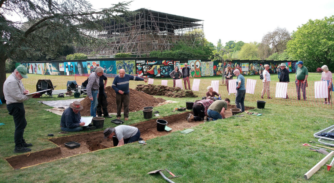
We had an interesting and enjoyable weekend in Broomfield Park at the start of our two-weekend exploration of what may be an undocumented ornamental canal behind the remains of the house.
Broomfield is known for the remains of its early eighteenth century water gardens, but it is also known from early mapping that these gardens were once more extensive and included several channels and ponds within the park, most of which were filled in probably in the early twentieth century.
Twentieth century aerial photographic evidence and geophysics surveys in the late 1990s suggest there was once also a water channel behind the house, but since it does not feature on any known map, it is hypothesised that this may be a relic of an early Baroque water garden close to the house that had already disappeared by the 19th century.
Archaeologists dug two small test pits on the 'canal' feature in 1997 and tentatively identified its western and eastern banks, but many unanswered questions remain. We have therefore been invited, as part of the Unlocking Broomfield project, to investigate this feature over the course of two weekends, to try and understand how big the canal was, when and how it was constructed, how it was supplied with water and when it might have been filled in.
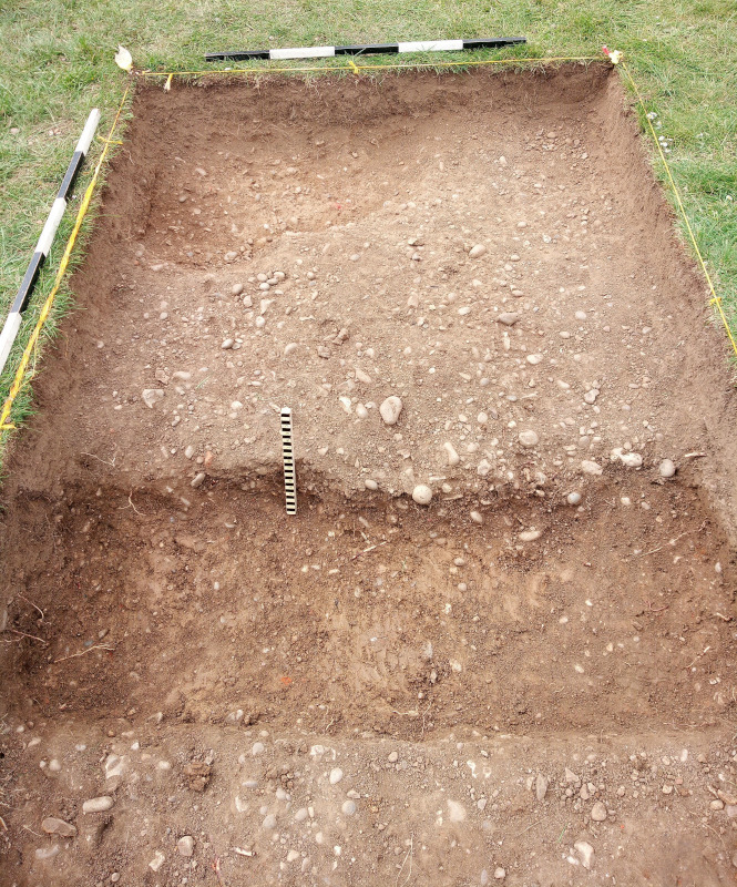
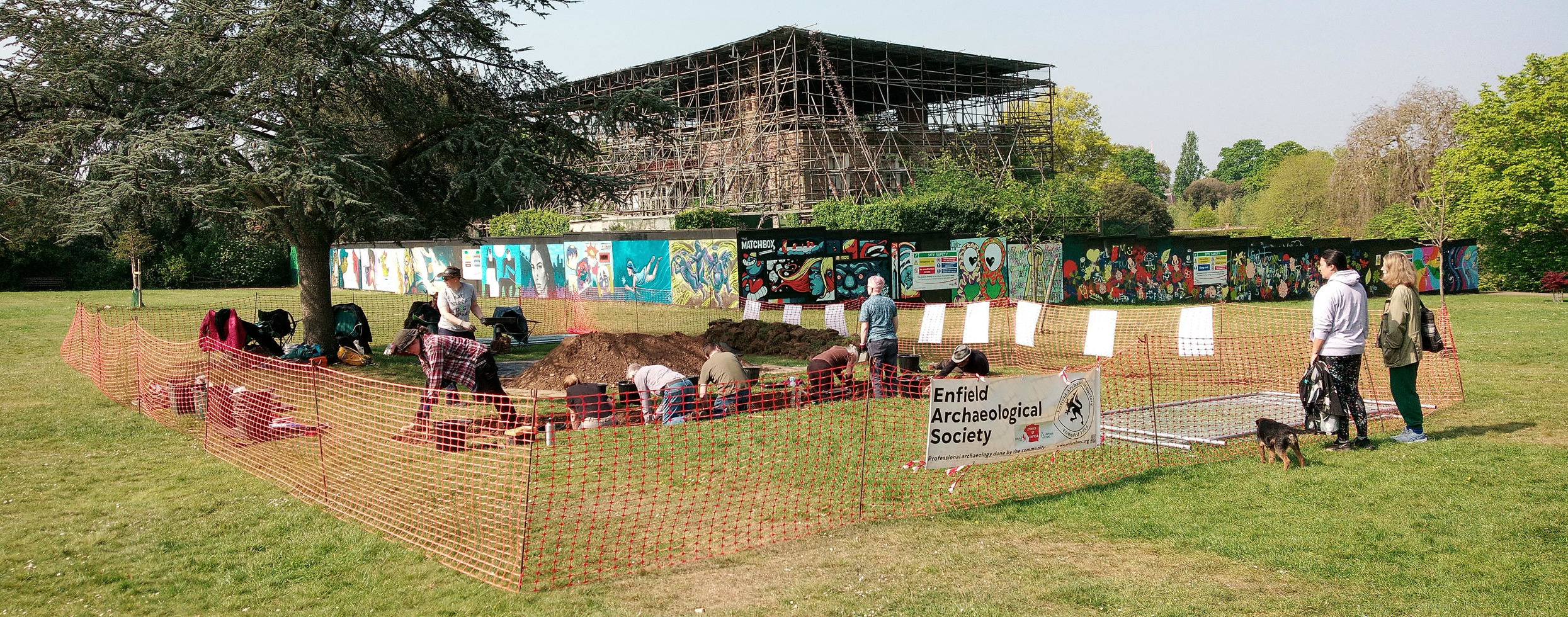
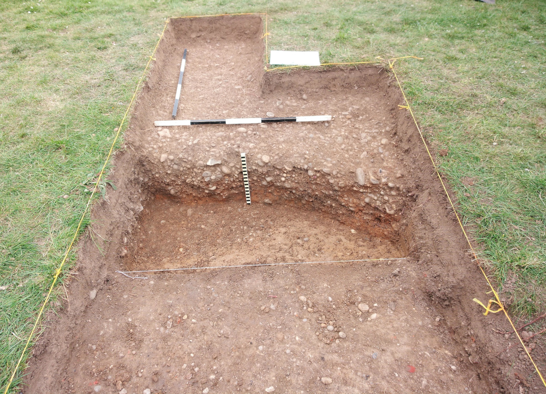
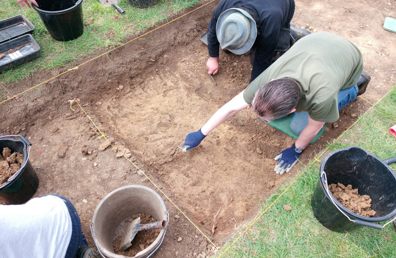
We therefore laid out Trench 1 on Saturday to get a complete section across the canal. Locating the trench was made easy by the fact that the line of the canal is very clearly shown on the ground by a band of dark green grass, about 6 metres wide running roughly parallel with the back of the house. After removing turf and topsoil we came very quickly, at both ends of the trench, to the expected compacted pebble surfaces that define the west and east banks of the canal.
The banks of the channel are fairly irregular and don't show any evidence of revetment - a fairly simple and cheap construction method which would also have served to provide a gravel path on either side of the canal.
The gravel bank forming the east side of the channel notably had been laid on top of a bed of orange sand. The 1997 test pits had recorded a bed of mortar, so it is possible that our sand layer was originally mortar, but decades of exposure to the water in the canal may have leached out the lime component leaving behind only the sand.
Between the two gravel banks we found a series of quite shallow deposits mostly composed of pebbles, brickearth and fragments of brick, and a notable layer of brickearth that appears to have been applied as a capping layer over the top, probably when the canal went out of use. It is this brickearth deposit that is causing the soil above it to retain moisture in dry weather, in contrast to the gravel banks, and so giving rise to the dark green grass above that causes the canal's location to stand out so well in the lawn.
Having removed these deposits, on Sunday we found the base of the channel, represented by a completely sterile natural brickearth, only about 40cm below modern ground level.
Although this is slightly unexpected, it isn't perhaps entirely surprising since, especially from the point of view of an ornamental garden, a body of water one foot deep looks pretty much the same as one six feet deep, especially from a distance.
This combined with the relatively rough construction of the gravel banks perhaps also shows that whoever built this feature didn't want to spend too much money on it!
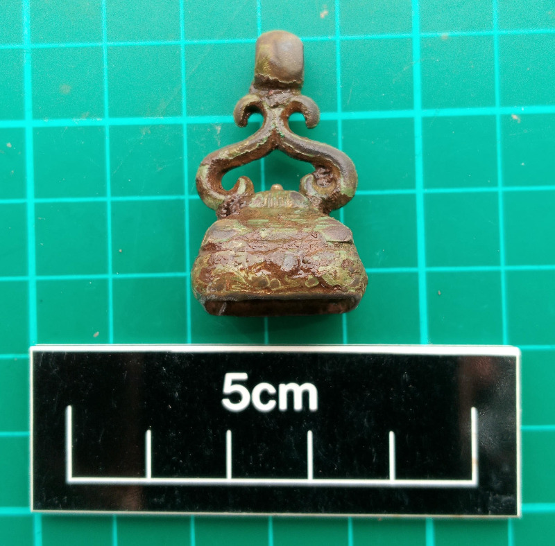
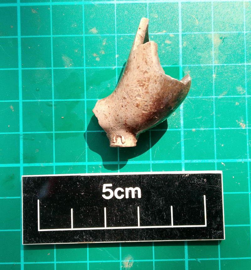
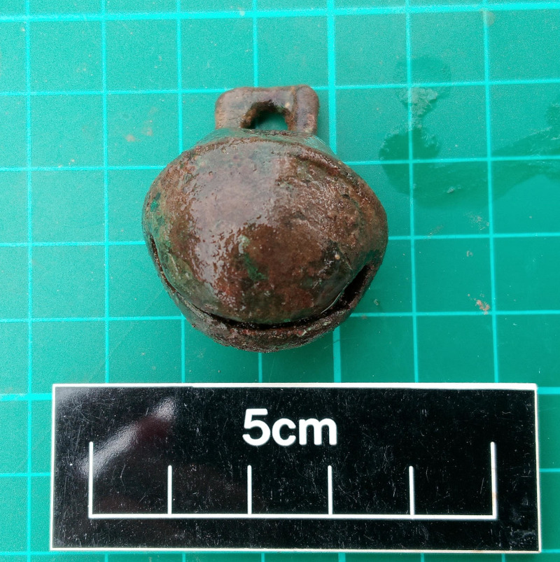
One main outstanding question about the canal is the date of construction. Although we did recover quite a number of finds over the weekend, principally of 19th and 20th century date, they were all associated with the infilling of the canal, rather than its creation. Thus the best we can say at the moment is that the feature went out of use probably in the late 19th or early 20th century, and may not have existed for very long.
The story isn't over, however, since we will be back in the park next weekend from the 3rd to the 5th May to open one more small trench nearby. Trench 2 will be located at the apparent northern end of the canal at the point where it may have been supplied with water (perhaps from a culvert).
We'll be keeping our fingers crossed that Trench 2 will supply us with some evidence for the canal's actual construction. The Saturday will be a public open day, with displays and activities for families, and opportunities for volunteers to join in the dig (over 16s only and subject to numbers).
For more background on the dig and answers to frequently asked questions see: The dig pdf